
St. Giles-in-the-Fields/St. Giles Rookery
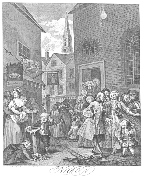
This sketch depicts St. Giles Rookery, the slum of the St. Giles district, with the church in the background.
Hogarth, William. “Noon.” The Literary Encyclopedia, 1738, commons.wikimedia.org/wiki/File:Hogarthgiles.jpg. Accessed 16 Oct. 2020. This work is in the public domain.

This depiction captures the harsh reality of St. Giles Rookery, including the overcrowding and unsanitary living conditions of the area.
Forster, John. “Printed Sketch of The Rookery in St Giles, 1817 [from the Author's Presentation Copy of The Life of Dickens, 1872-74].” British Library, London, 1817, www.bl.uk/collection-items/printed-sketch-of-the-rookery-in-st-giles-1817#. Accessed 16 Oct. 2020. Public Domain Mark 1.0.
St. Giles, London is a district in the south-west of the London Borough of Camden. The parish, St. Giles-in-the-fields, is also known as the Poets’ Church. There have been three churches of St. Giles-in-the-fields, the most recent of which was established between the years 1730 and 1734. The surrounding area was first given notice as a district in 1118 when Queen Matilda, wife of Henry I, founded a hospital for lepers along with a church and monastery. The hospital chapel and the parish church of St. Giles appear to have been two distinct structures under a single roof. The hospital chapel became a parish church in 1542, of which the surrounding area became the parish burial ground. The encompassing area was large, covering from Lincoln’s Inn Fields, to Charing Cross Road, to Seven Dials, and then all of Bloomsbury. Gradually, a village developed around the church and first emerged as a wealthy suburb in the 1600s. St. Giles expanded more rapidly in the latter half of the seventeenth century. By this time, Irish people, Greeks, Armenians, and Huguenots from France had settled here, seeking work and protection. By 1711 the population was estimated at 21,000. The parish of St. Giles, though among a lower class neighborhood, is richer in historical materials than those in neighborhoods of a higher social class. Even still, this refers mostly to the history of London’s vagrancy.
St. Giles Rookery was one of the worst slums within Britain, then characterized by overcrowding and narrow streets. As home to immigrants, thieves, addicts, and sex-workers, the Rookery became synonymous with the gin craze and carried on ridden with violence and crime for over a century. Emigration due to the potato famine in the 1840s led to a high Irish population in the area. By 1851, the population had risen to over 37,000, and the subsequent overcrowding and lack of drainage led to major outbreaks of disease to the point of the area being regarded as a center of infection. A battle between the police and a gang of counterfeiters in 1840 marked a turning point in the slums, eventually allowing for its clearing several years later. In this process, New Oxford Street was driven straight through the middle of the Rookery, the worst part of the slums, as a method of "decontamination by demolition" ("St Giles"). However, this mostly led to overcrowding of the surviving houses. Over time, the many breweries and workshops in the parish took over these houses and allowed for a decline in population.
Charles Dickens held great concern for London’s slums and campaigned for their improvement around the time he began writing Bleak House. “Sanitation” surfaces as a common theme in the novel, especially on the topic of the brick-maker’s house and Tom-all-Alone’s. The depiction of the poor in Bleak House well represents Dickens’s desire to highlight the potential genuinity of people living in unfortunate circumstances. Although St. Giles Rookery is not mentioned by name in the novel, it is evident that Dickens emphasizes the significance of the harsh conditions in slums such as this one.
Works Cited
Carter, Leighton. “The Slum of All Fears: Dickens's Concern with Urban Poverty and Sanitation.” Victorian Web, www.victorianweb.org/authors/dickens/bleakhouse/carter.html. Accessed 16 Oct. 2020.
Thornbury, Walter. "St Giles-in-the-Fields." Old and New London: Volume 3. London: Cassell, Petter & Galpin, 1878. 197-218. British History Online. Web. 16 October 2020. http://www.british-history.ac.uk/old-new-london/vol3/pp197-218.
“St Giles.” Hidden London, WordPress, hidden-london.com/gazetteer/st-giles/. Accessed 16 Oct. 2020.
“St Giles-in-the-Fields Church: History.” Church of St Giles, www.stgilesonline.org/history. Accessed 16 Oct. 2020.
Parent Map
Coordinates
Longitude: -0.128399500000