
Map of Valdichiana Valley
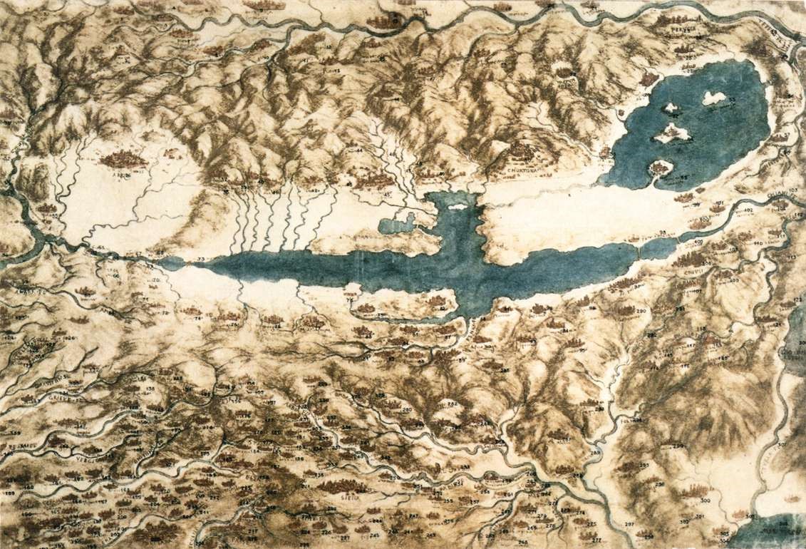
This map was supposedly created when the Da Vinci was still in service of Cesare Borgia. Yet there is evidence that there was little military purpose. While the locations all have names, the rivers are detailed with names as well. Many believe that Da Vinci created the map to build a canal from Florence to the sea. Using the map created, one could plan a dam for Lake Chiana, allowing the canal to be used even during the dry season. Due to this fact, the map seems to serve a more commercial purpose. Alas, it could also be used for transporting soldiers and equipment as well. As the canal was never made, the purpose of the map, or the canal, is not truly known.
Sources:
“Map of Tuscany and the Chiana Valley.” Web Gallery of Art, wga.hu/html_m/l/leonardo/13maps/2tuscany.html.
“A Map of the Valdichiana.” Royal Collection Trust, www.rct.uk/collection/912278/a-map-of-the-valdichiana.