
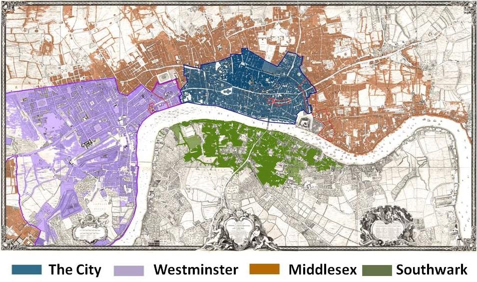
In the image, there are 4 sections, Westminster, Southwark, Middlesex, and "the city." Bleak House takes place mainly in "the city," but also incorporates other parts of the map as well. To look at the different sections within this map, first Westminster. This includes the Westminster Abbey Cathedral, but not just that. for well over a century prior to the 19th century, this area had been established with the royal palace, parliament, and other judicial constructions (Court of Burgesses). This area was a place of extremity for both sides of the spectrum for wealth as those who were poor served as the support systems for the gentry and aristocracy. Each section had its defining features of local government. The City portion of the map was the designation for a local government comprised of wards and parishes, magistrates, and guilds. Their local government structure had a high participation rate despite its hierarchy within the system structure. It is also important to realize that the portions within the London Medieval walls held a good number of wealthy individuals whereas outside the walls held a lot of poor individuals. The Middlesex held the rural parts of London and Southward along the south side of the Thames river held only a small portion of the London population even in the 1800s. Although the image is taken from a map created in the 18th century, the structure and local government politics hold relevant to the 19th century London structure with influence in some cases and consistency in others.
“London Lives 1690 to 1800.” Background - Westminster - London Lives, www.londonlives.org/static/WestminsterLocalGovernment.jsp.